Monday, September 15, 2014

Day 10 Fort Bragg - Manchester Beach

Poor cell coverage and no wifi means you are reading this tomorrow, or later. Today was a recovery day. We strolled a couple miles from the state park unto Fort Bragg and found a cycle shop open! Fort Bragg Cyclery is a cyclist's bike shop. The kind of place I would like to own. The owner is also the mechanic and he knows his stuff. He fixed Rhonda's front derailer, replaced her worn brake pads (remember yesterday's 12 mile descent?), and replaced her second tire. For kicks he adjusted my front derailer and cleaned both chains. While that was going on the shop suggested a fine breakfast locale and told us where the laundramat was located (getting short on clean cycle shorts). Before the clothes were dry the cycle shop called and said all was done. I can't believe that dropped all other work to care for us. When in Fort Bragg, visit the Cyclery shop! 


It was nearing 1p when we left town and planned for an easy 40 mile ride. No big hills? Right...
We gained over 2000 feet again; the same 200 over and over. At each creek crossing the highway took sweeping curves from the top of the bench dropping fast to sea level. There are no shoulders of course, so with traffic we too must take the sharp turns at slow speeds(good thing Rhonda got new brake pads). Then it was the same elevation gain, only steeper. Most of these were just plain hard, but doable. Until we came to a Elk creek. But before we talk about gravity being the law, let me say something about the village of Elk. Elk, CA is a clean, quaint, welcoming wide spot in the road. The grocery store and deli had all you really need. We were 13 miles from camp so we had the deli make us some awesome sandwiches which we packed away for later.  Behind Elk, the hillsides reminded me of Council and Cascade, ID, and I'm sure Wapiti inhabited them. 


Just south of Elk is Elk Creek and the highway drops around three sweeping curves, 300 feet to sea level. And then it gains all those and more in about 1/2 the distance. It was the hardest hill I've ever climbed. I'd only come back again just to see Mark Bertram climb it in the big chain ring. It was all mental effort. One car meeting us on our way up stuck their head out the window and whooped and hollered encouragement to us, and that's when I stopped. I lost concentration and I couldn't get my legs to shut up. After a few minutes breather I jumped back on and tried to get the pedals to turn. I was climbing ever so slowly, but with only one foot clipped in its peddle. Then this wall appeared! A black slab of asphalt that stood straight up and was mistakenly called the road bed. Just then I started weaving and a car came up behind me and the hill won! No way was I going to spin myself up that switchback, so I called my manhood into question as I WALKED the bike around the corner. Of course Rhonda motored right on up and stopped around the corner as it leveled out to a normal 10% grade. Without word I mounted the bike and spun it up the remainder of the hill. For the next 5 miles I didn't say a word.  

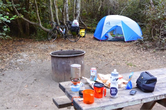
Manchester beach soon called us in. The state park is really primitive (meaning no showers and only pit toilets), so we are camped down the road at a KOA. After eating our awesome sandwiches from Elk and all the hot water you need for a shower we are totally relaxed and recovering for tomorrow. 

We are less than 150 miles from San Francisco and I'm just a little impressed how remote the coastal highway is. Not much civilization between us and the Bay Area. Perfect.  

Day 9. Garberville to Fort Bragg

Untitled by jheggen at Garmin Connect - Details
There are always days like this when backpacking and climbing. They are usually early on in the trip. Sure the summit push is the toughest day, but that is why we are there. But often the grunt is the approach to high camp. Or it is the slog up a steep hill to our first alpine lake after we leave the designated trail. You know it's coming and there is always that dread leading up to it. The packs are heavy and your legs are untested. That's when Dave Fischer says, "we got it to do". 

While planning our trip Rhonda kept talking about the climb out of Leggett. And sure enough the elevation profile shows this anomally, a huge jump in the endless ups and downs. For the last two days we have been climbing along the Eel River valley. It's not a gradual climb. Instead there is this two steps up, one step down approach. If you are a math whiz, you could do a regression analysis and the line would a standard exponential growth pattern.  The profile looks like those graphs printed out of your heart rhythm. And then there is this spike, as if the cat jumped out at you at 2am when you get to go to the bathroom. Yikes! 

We left Garberville after a good rest and cruised steadly up the road. Lunch was this outside hippy grill near Standish Hickey. A grilled turkey sandwich with avocado (we are in CA) and fresh squeezed organic lemonade to cool the 90 degree temps. Then we left the 101 for the CA hwy 1, and we got it to do. 

It was a long and winding grunt up, at 7+%. I found my granny gear and left it there. The sign at the bottom said no motor coaches or pulled campers over 40' but that didn't stop them.  Up we went in the heat. We left the hippy grill with our two 24oz water bottles full. The map said 28 miles to the next services and I was worried I would run out. We stopped three times on the climb up, getting the heart rate down and giving the legs a break. As the garmin showed us nearing and going over 1800' ( I know Louie, it doesn't seem that high or tough, but you are not here), I kept thinking the next switchback would be the last. Finally we rounded a corner and there was no more up. Now the reward.

For the next 12 miles we cruised down and around, clicking off the feet towards the ocean for the first time in 2+ days. My mountain experience and what little physics I had in school taught me that the temp should increase as you descend. At half way down we pulled over to cool the brakes, but also add some layers. Rhonda put on a jacket and I added my vest and arm warmers. Arm warmers could be a stylish shirtless sleeve. Mine are black and cut the wind and keep my arms warm, hence the name. 

When people ask me where I grew up, I say, "I haven't". When mom said 'don't touch the stove top because it's hot', I did, and so I just had to see how hot my disk brakes really got. I'm glad I bought my bike with disk brakes. They really work and they get really hot!

By the time we reached bottom the temps dropped to 58 and the marine layer hid the yellow orb in the sky. And then another hill! What? A hard 500 foot climb back up before we could see the sea. 

Our water was running low and we still had 9 miles to the next "full service" village, Westport. The one store was able to provide us directions to the garden water spicket and sold us some Grandma's cookies and told us the next town with real food and camping was 10 miles away. Our map said 13, and my legs thought it was 20. From now on the coastal road will be a series of steep curves descending the washes, followed by steeper climbs, one after the other. They would be fun on my road bike with no traffic. 

We found a hiker/biker camp with a nearly full service market, with ham sandwiches and a small bucket of potato salad. I'm writing this as proof they didn't give us food poisoning. We shared camp with an older German couple. We shared coffee this morning before we headed into Fort Bragg for a bike shop and bike maintenance, and more laundry.

Our coffee brought back memories of Tug, Jim, and Tina. I hope they are well and wonder where they are. I miss them. 

Saturday, September 13, 2014

Day 8: Ferndale - Garberville

Day 8: Ferndale - Garberville by jheggen at Garmin Connect - Details

Ferndale was a nice stopover and a rest well appreciated. The town is clean and supported by the surrounding dairy country and tourism. 

Refreshed we started out of town on the edge of the marine layer and chilled air. We took the country roads and headed inland following the nearly dry Eel river, through farm land occupied by more California happy cows.  The road grade was a generally slight 1-2% grade with the occasional steep bump at 7%.

 It was about the second bump that we had our first flat and blown tire. Rhonda's front tire went flat and after two inner tubes we realized the tire's bead had failed. So, after a longer than required break we installed the spare tire and headed up the road. 

Soon we entered the "Avenue of the Giants", an off Hwy 101 route along more of the Redwoods. It was a most pleasant ride. The redwoods provided much needed shade as the temps finally climbed as we rode inland. There were some fruit and veggie stands interspersed in between the various small towns, which aided in our scurvy prevention. 


Because of the need for another spare tire, and knowing tomorrow is Sunday, we kept the pace to make it to Garberville before their all purpose sport shop closed at 5:30.  We made it with 10 minutes to spare. 

When not under the shade of trees, the temps rose into the 90's, a big difference from the coastal 60's. For some reason we thought we could make it another 15-20 miles. While eating dinner in town we realized we only had another hour or so of day light and the heat just took it out of us. No safe camping in Garberville, so we are in another motel tonight, and I'm glad this one has AC.  

I didn't get many photos today, but took some video riding through the redwoods. That will require me some time at home to edit it all, so come back later at the end of this adventure.  

Humboldt county has more than its share of culture, and counter culture. Each of the towns with its own character, or several characters for that matter. 

Tomorrow's ride takes us up our steepest, longest, highest hill of the trip, and they say it will be hotter. So it's time to say good night. 

Friday, September 12, 2014

Day 7 Trinidad to Ferndale

day 7 Trinidad to Ferndale by jheggen at Garmin Connect - Details
We have passed the halfway point of our adventure and here are a few ride stats for the last 7 days:
Count:7 Activities
Distance:386.24 mi
Time:31:32:46 h:m:s
Elevation Gain:17,618 ft
Avg Speed:12.2 mph
Avg HR:113 bpm
Avg Run Cadence:--
Avg Bike Cadence:--
Calories:10,198 C
Patricks Point was a quiet nice camp. You could hear the surf and sea lions in the distance. By sunset the marine fog rolled in. Two others were in the hiker/biker camp, one of each. The biker was averaging 80 miles a day, so I feel a little subhuman. Of course he was much younger.  

Today's route had a little of everything. Single lane, freeway, road construction, bridges and even some Gravel. The route took several off highway routes and gave us much variety.  Breakfast was 8 miles down a scenic road to the village of Trinidad. A nice seaside community. We ate in a small organic counter culture coffee shop and I ate an egg frittata that looked like quiche to me. It was good and the organic coffee even better. 


As we neared Arcata, the route took us on a very nice green belt along the outskirts of town. It was nice not to have to worry about the traffic. Arcata is the home of Humboldt State U. I hired and worked with many great Idaho game wardens who graduated from there. A nice looking campus. 

Then the route took us to and through Eureka, and that's all I'm going to say about that.

Once again the route left the 101, thankfully! We came upon a nice little old dairy town of Loleta. We saw some California happy cows and toured a cheese factory. We took the old highway out and into our destination for the night.


Ferndale is a great Victorian era town on the Eel River. The county fair campground we planned to stay was hosting a festival, so we are in the Frances Creek Inn, which just happens to be next door to the Ferndale Pizza parlor and across the street from the laundry. If you wonder why we have to do laundry so often, I have two words for you, "bike shorts", and we only carry three pairs with us. 

Today's ride was very relaxing. I'm learning. No big climbs today. Although still tired, the legs are not as sore as they have been. Looking forward to a comfortable and restful night's sleep.


Thursday, September 11, 2014

Day 6: Crescent City - Trinidad (Patrick's Point State Park)


54 miles, 3500 ft elevation gain, 4 hrs 50 min ride time, one piece of Apple pie and one package of hostess mini crunchy doughnuts. Limited connectivity so the Garmin data can't upload. 

This is our second day in CA. Oregon set a high bar for a biker friendly ride. A goal that CA will have to work hard to meet. Maybe it's just because I'm tired, for the second day in a row. Last night's motel was a nice respite in crescent city. We had first floor room with a view of the ocean. Nice accommodations and affordable. Even the bed was comfortable. Better than any backpacking trip I've been on. Still, I was not there long enough. Even with sleeping in some, I could use some recovery time. My body is beginning to agree with Rhonda: 'we are not in a race. We can go at our own pace, take our time, enjoy the journey'. And then there is Isaiah who heard The Lord say, "Even to your old age and gray hairs, I am he, I am he who will sustain you. I have made you and I will carry you; I will sustain you and I will rescue you."- Isaiah 46:4

Right off the get go we had a 1000 foot climb at up to a 7.5% grade. And for most of the way up, and in fact for many miles today, there was not a decent shoulder to ride in. And although it only takes one, or in this case, four vehicles decided they were bigger than us and passed with only inches to spare. It just sort of ruined the day. It was stressful trying to keep the rubber side down and watch for those motor coaches with extended mirrors pulling their toys. Because for every hill climb, there is this windy decent down the back side, usually the payoff for the hard work climbing up.  There were a few nice descents cruising down with little traffic, especially in Redwoods national park. But enough whining.

I have read about the redwoods since high school. I always expected them further inland (like the Sequoias, but those are completely different critters). Still, these trees are huge and old. It's been cool to ride through them on bikes along the coast. I'm glad someone invented Trex for building decks and some of these giants remain. 


The area is also pretty rural between the bigger towns. We knew tonight's camp would be too far to find food near by. So we stopped in Orick. The market was sparse but we found some bars and nuts for the morning. Just enough to get us into the next town 8-10 miles down the road. The Palm cafe sat across the highway and we ate a greesey burger for a late lunch, early dinner. Mark Morgan says I can eat a piece of pie each day. The Palm cafe did make a good homemade apple pie that I shared with Rhonda. 


Then it was back on our bikes for 15 more miles and another 1500 feet up and down, winding along the coastal lagoons. We even saw a herd of elk just out of the park.  The sign to Patrick's Point State Park was a welcome site. CA parks do meet the OR standard for hiker/biker camps. Rhonda is taking her shower while I type and listen to the surf. I even hear a sea lion every now and then. And I'm looking forward to a Mark Bertram favorite: hostess crumb doughnuts.


Wednesday, September 10, 2014

Day 5: Gold Beach, OR - Crescent City, CA

Day 5: Gold Beach, OR - Crescent City, CA by jheggen at Garmin Connect - Details

Hi this Rhonda writing today. Well, as Jon would say, "anyone can do it in the sunshine"; it was sunny & gorgeous, except when we were really tired the tailwind became a headwind & tried to beat us! Today was long but filled with absolutely stunning landscape around each turn. 


We started out with hills right out of Gold Beach but were rewarded with great downhills making it very type one fun for those stretches. We saw Tina at the bottom of the first hill & said goodbye to her because she was planning a short day. Hope we see her again before we are done. 

We climbed off & on all morning, breaking for lunch in Brookings, OR. As we pulled in for lunch we saw Steve & Art having lunch with Steve's wife, their sag driver, and we're celebrating being finished with their ride. We were pretty much beat at this point also & wished we were done for the day also! The afternoon was fairly flat even though we had a headwind, we made good time. Our reward was finding a motel in Crescent City, CA. The shower, bed, dinner within walking distance, laundry facilities and did I mention a bed, all made the day worth it. Now off to tend to our sore muscles!!! Today was type two fun, fun when it was done...


Tuesday, September 9, 2014

Day 4. Bandon - Gold Beach


day 4. Bandon - Gold Beach by jheggen at Garmin Connect - Details
62 miles today. Our longest day and my legs can feel it.  I had to keep reminding myself of Jens Voight telling my legs not to hurt.
A little bonus from last night. We can add another 10 miles on the day. 2 into town for laundry and supper with 2 back to camp and then 3 miles out to the beach to catch the last rays of the sun. Yes the sun shone and gave us a sunset and another lighthouse, and three back to camp.

When we returned to the hiker/biker camp we met up again with Tug and Jim, and Tina.  Bullard state park is one of the nicest state parks I've ever visited.  The biker section is new, complete with a solar powered "devise" recharger for the mobilely connected, AND a hot shower. There were also many other bikers there last night.  
We awoke and shared some coffee with Tug and had a great visit before 7am. What a character; a retired economics prof from the university in Monctun. He and Jim would stop in Bandon for laundry and catch up on whatever. We are not sure where they ended up today. I already miss them. 

It took us 8+ miles to find breakfast in Langlios. It was a greasy spoon. No really, that was the name of the place. A small diner on the side of the road that looks forgotten, but the food was wholesome, just like grandma cooked. 
Tina caught up to us there. We decided we would trek to Gold Beach for our last night in OR. After a few calls we got the local fairgrounds who said would open up the place, including their showers. Our tent is staked on some green grass right in front on the pavilion and soon afterward Tina rolled in. 
The gal from the fairgrounds suggested the "Crow's Nest" for pizza. Dave Fotch would love it for a Friday night dive bar hopping. It's not much to look at, but it has local character. We sat down at an empty table and after a while the single loan waiter asked if we could move beacause the group next to us was expecting more company. But Joe and Linda wouldn't have it. They invited to join their Tuesday night "aqua night" with about 5 other retired couples. What a hoot. Rhonda whittled down even more of her million best friends she has never met.  It happens Dave saw us earlier in the day as we rode past his golf course on the Cedar Valley Road, an alternate route off the 101.  Sometimes the bike route takes us off away from the heavy traffic, as if we were lost. The group even bought us drinks, and the pizza was the best, lots of garlic!  After two hours of pure joy we needed to get back to camp before it got dark.  

I promised to tell you about the OR highways, at least the coastal highway. The weekend was busy with Willamete tourist traffic. I can't blame them for taking advantage of the local coastline.  It has taken me 4 days to get used to the traffic. Since Monday the traffic has slowed, but there is still heavy truck traffic as well as all those retired guys driving their motor coaches pulling a PT Cruiser. But I must say that the vehicle traffic, local, tourist, and commercial is nothing but generous to bike traffic. I just pray each time a camper passes that their door step was pulled in and their rear view mirror passes over instead of through my helmet.
OR has done a great job keeping the 101 bike friendly. It is a well marked bike route and the road is swept clean, with plenty of shoulder; well most of the time. 
ODOT(Oregon dept of transportation) produces a highway map just for the bike route. It shows the route, mileage, elevation profile, and shows where the highway has 3 foot shoulders or not. And it's free. The Adventure Cycling maps have better detailed descriptions for amenities, but they come with a price.
Also, OR tends to cater to the idea that life is the journey. Rhonda keeps encouraging me to relax, travel at my own pace and not be in a hurry. I am supposed to be the retired one in the family.  I need not worry about our distance each day and our average speed, the grade of each climb and number of calories I'm burning. Nor do I need to worry if we keep up with Tug and Jim or those cheaters with the sag wagon. This is OUR adventure. (Did I mention I already miss Tug?).
OR highways help out in this manner. Seldom if ever do we see road signs that mention the next whatever is only 3 miles down the road. The best they do is make note of the next large city 100's of miles from the last large city. You just roll on down the road and every now and then you round the bend and find the quaintest small town with the best food ever, over find a pull out with the grandest of views. What OR doesn't spend on mileage signs must go into their coastal state parks. 
So now I will simply enjoy the ride with my bestest friend and wife, savor the time together and live the adventure far.